The weather this August has been nothing short of brutal for Japan and South Korea. We aren't just talking about a rainy season that overstayed its welcome. We are looking at atmospheric events that shattered historical records in minutes. When cities like Chiba receive over 100 millimeters of rain in a single hour, the infrastructure of even the most developed nations struggles to keep up.
This isn't just bad luck. It's a fundamental shift in how moisture behaves in the atmosphere. Don't forget to check out our previous article on this related article.
Why Hour-Long Deluges Are So Dangerous
Most people think of flooding as a gradual process. You watch the water rise, you pack a bag, and you head to higher ground. But these recent events in Chiba and Geoje demonstrate something else entirely: the "flash" in flash flood.
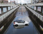
When 115mm of rain falls in sixty minutes, the ground acts more like concrete than soil. It simply cannot absorb that volume of water. Drainage systems—designed for older, more predictable climate patterns—become overwhelmed instantly. That is how you end up with cars trapped in sunken underpasses. If you’ve ever wondered why officials are so aggressive with evacuation orders, this is why. A few minutes of hesitation can mean being locked inside a rapidly filling metal box. If you want more about the context here, BBC News provides an excellent summary.
The Science Of Extreme Precipitation
Japan’s geography is a perfect trap for these events. You have warm, moist air coming off the Pacific colliding with cooler air masses. This conflict creates massive, localized instability. In the past, these storms might have moved through a region quickly. Now, we are seeing them stall or intensify due to shifted jet streams and higher sea surface temperatures.
South Korea’s experience in Geoje, where over 400mm fell overnight, points to the same underlying issue. The atmosphere is holding more water vapor than it did fifty years ago. A warmer atmosphere holds roughly 7% more moisture for every degree Celsius of warming. That sounds like a small number on paper. In practice, it turns a heavy rainstorm into a catastrophic deluge.
Lessons From The Ground
If you live in a flood-prone area, don't wait for a level 5 warning to think about your safety. These systems are reactionary by nature. They trigger when the rain has already started destroying the environment.
- Know your elevation. If you live near an underpass or a low-lying basin, have a plan for where you’ll go before the rain starts.
- Never drive through standing water. It’s the number one cause of fatalities in these events. You cannot judge the depth, and once your car hits a certain level of water, the electronic door locks may fail, or the water pressure will pin your doors shut.
- Emergency kits matter. When power grids fail—like they did for 20,000 households in Chiba—your reliance on the digital world vanishes. Keep a battery-powered radio and enough food for 72 hours.
Beyond The Headlines
It is easy to focus on the immediate tragedy. However, look at the wider Pacific context. As Hurricane Lala moves toward Hawaii and Typhoon Saudel targets the Northern Mariana Islands and potentially Okinawa, we are witnessing a hyper-active season. Meteorologists aren't just tracking one storm; they are tracking a sequence of energetic systems.
The infrastructure in Asia is among the best in the world for managing typhoon risks. Yet, even they are hitting a wall. We have to reconsider how we build our cities. We need more permeable surfaces, better flood-mitigation barriers, and perhaps a total rethink of underground infrastructure.
We are living in an era where the term "unprecedented" is becoming common. Stay observant, keep your emergency plans updated, and stop assuming that the historical record is a guide for the future. It isn't. The climate is moving faster than our civil engineering.